Our ‘River Front’ town, Franklin by Carol Cane, 2023.
A short ‘history’ of the growth of the Franklin township which relied on water transport almost completely until the development of the road links to Hobart enabled by bridging the river at ‘Huonville’ in the 1870s.
Since the escaped convict, ‘Martin’, was discovered, probably camping near ‘Price’s Creek’ about 200 years ago, this part of the Huon River has experienced many transformations. The swampy tree fern covered mud flats with often shallow river depths were considered unsuitable for agricultural pursuits by early explorers. The river was bordered by steep hills to the west, covered with timbers towering up to 200 feet (70m) with a dense understorey some 20 feet (7m) high.
Since the escaped convict, ‘Martin’, was discovered, probably camping near ‘Price’s Creek’ about 200 years ago, this part of the Huon River has experienced many transformations. The swampy tree fern covered mud flats with often shallow river depths were considered unsuitable for agricultural pursuits by early explorers. The river was bordered by steep hills to the west, covered with timbers towering up to 200 feet (70m) with a dense understorey some 20 feet (7m) high.
Those reports pose the question, ‘Why did John Price purchase over 600 acres (240 hectares)’ in this location? He obviously saw potential for farming. Jane Franklin had faith, so purchased his lots believing that she could establish a settlement of ‘Utopian farmers’ for teetotalling, Christian (not Catholic) free men/families. Applicants were interviewed and vetted by her and were provided with supplies and tools to work the land, all rent free for one year.
Jane Franklin provided a chapel, set aside 50 acres of land for a college and had the ketch ‘Huon Pine’ built at Port Davey to service the ‘Settlement’. The Chapel, ‘St Marys’ was consecrated by the Bishop Nixon on her farewell visit prior to her and Governor, Sir John Franklin’s departure from the colony in 1843.
Jane Franklin provided a chapel, set aside 50 acres of land for a college and had the ketch ‘Huon Pine’ built at Port Davey to service the ‘Settlement’. The Chapel, ‘St Marys’ was consecrated by the Bishop Nixon on her farewell visit prior to her and Governor, Sir John Franklin’s departure from the colony in 1843.
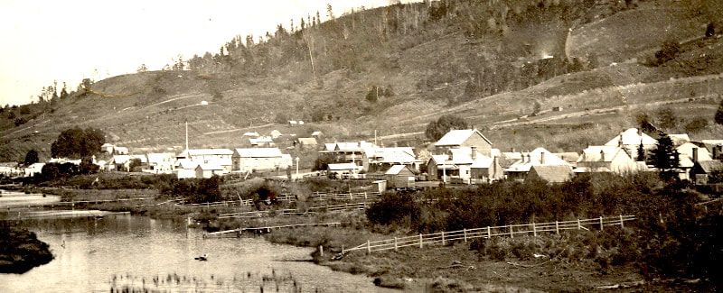
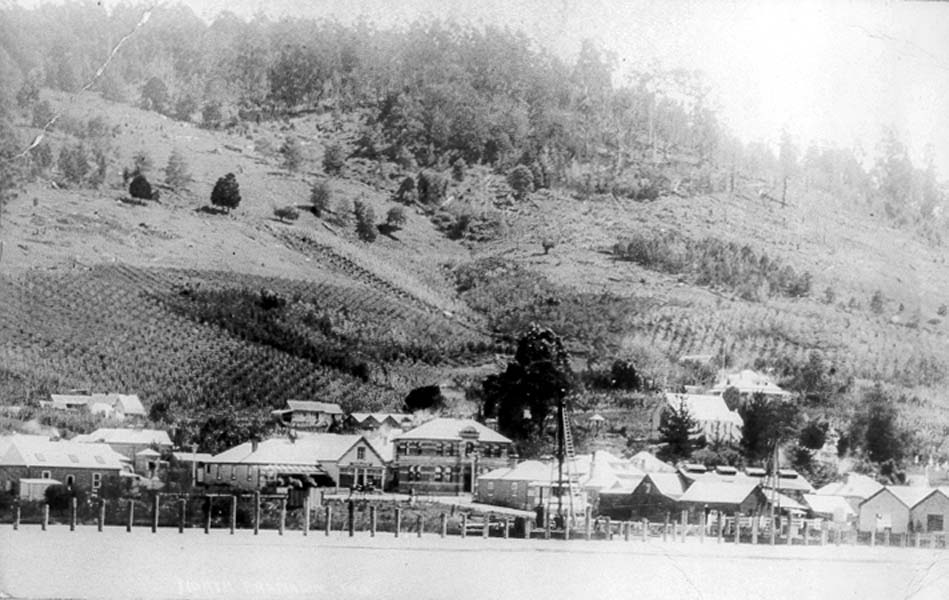
1. Central Franklin. Lady Franklin Hotel in centre. Note: Young orchards on the cleared land.
Small jetties, some of which were quite lengthy in order to reach deep water, appeared as more people and businesses became established. In places where the swamp was extensive, channels were cut through and residents would access the river by punt in order to meet the trading vessels. Some of the paths of these can still be observed today. As the Settlement developed where there was access to deep water, two main wharves were established.
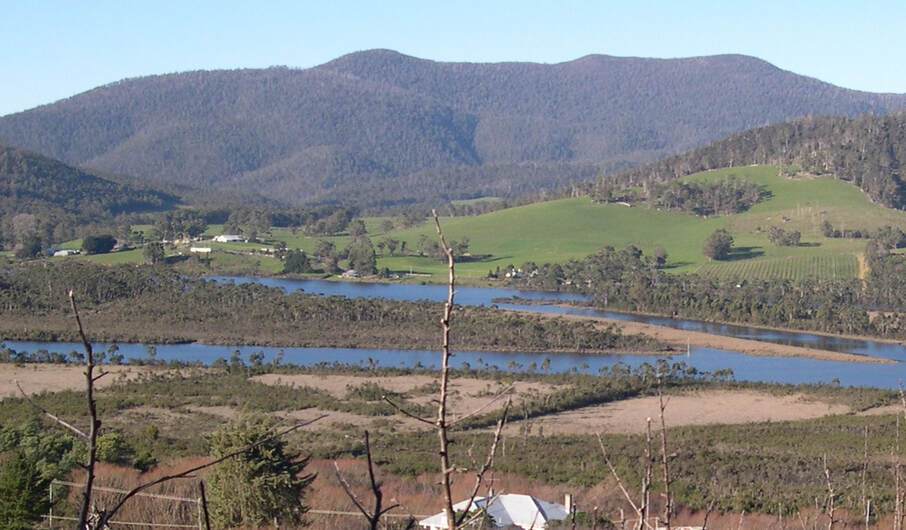
2. The line of trees across the swamp marks the remains of the channel below ‘Swamp Road’ (Photo: T Cane)
The Steamer Stores, adjacent to Price’s Creek and Mr. Kennedy who took over Fred Merry’s business, built a large storage and wharf facility just south of the Courthouse. Peacock built a fruit receiving depot and later a jam factory at the rear of the Steamer Stores, adjacent to a supply of fresh water. Raspberries, a reliable ‘cash crop’ for early settlers, from as far as Glen Huon were delivered by water and overland.
3. Centre - New Road Wharf adjacent to the ‘Evaporating Works’. (Photo: ‘Dallas’, C Cane)
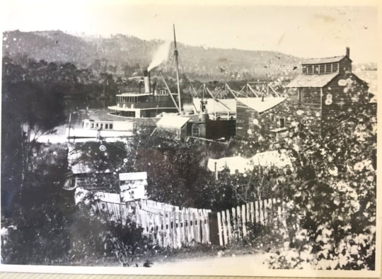
4. Ferry at New Road Wharf.
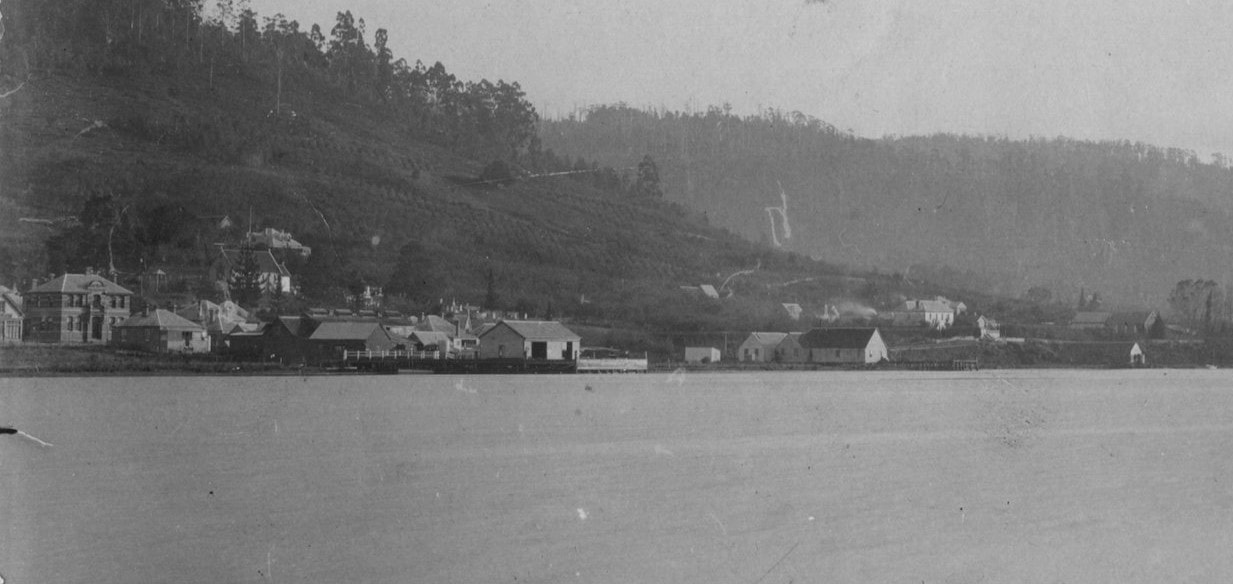
5. Steamer Stores at far left. Orchard Lea (Rowe) over the river. Postcard (source unknown).
On the northern bank of Prices Creek, Thorpe of nearby Kent Hotel, built a craft (boat) building site, which is where the May Queen was built. Another site, owned by Cuthbert, was below his property where, today, yachts are being moored. This property is now the site of Huon Regional Care.
The local rowing club was housed below the Kent Hotel, (as seen in the photo above), moving to the present location after the reclamation. Mr Yeates and Mr G Smith being named on the original title for the club.
A boat launching ramp is located a short distance downstream from the rowing club.
A private berthing pontoon further south has had to be closed, thus limiting casual facilities at this location. Support is being canvassed for it to be rebuilt.
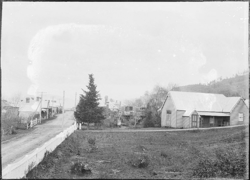
6. Main Road prior to widening. (NS392-1-820).
Fast forward to 2023. Franklin is the only historic town in the Huon Valley.
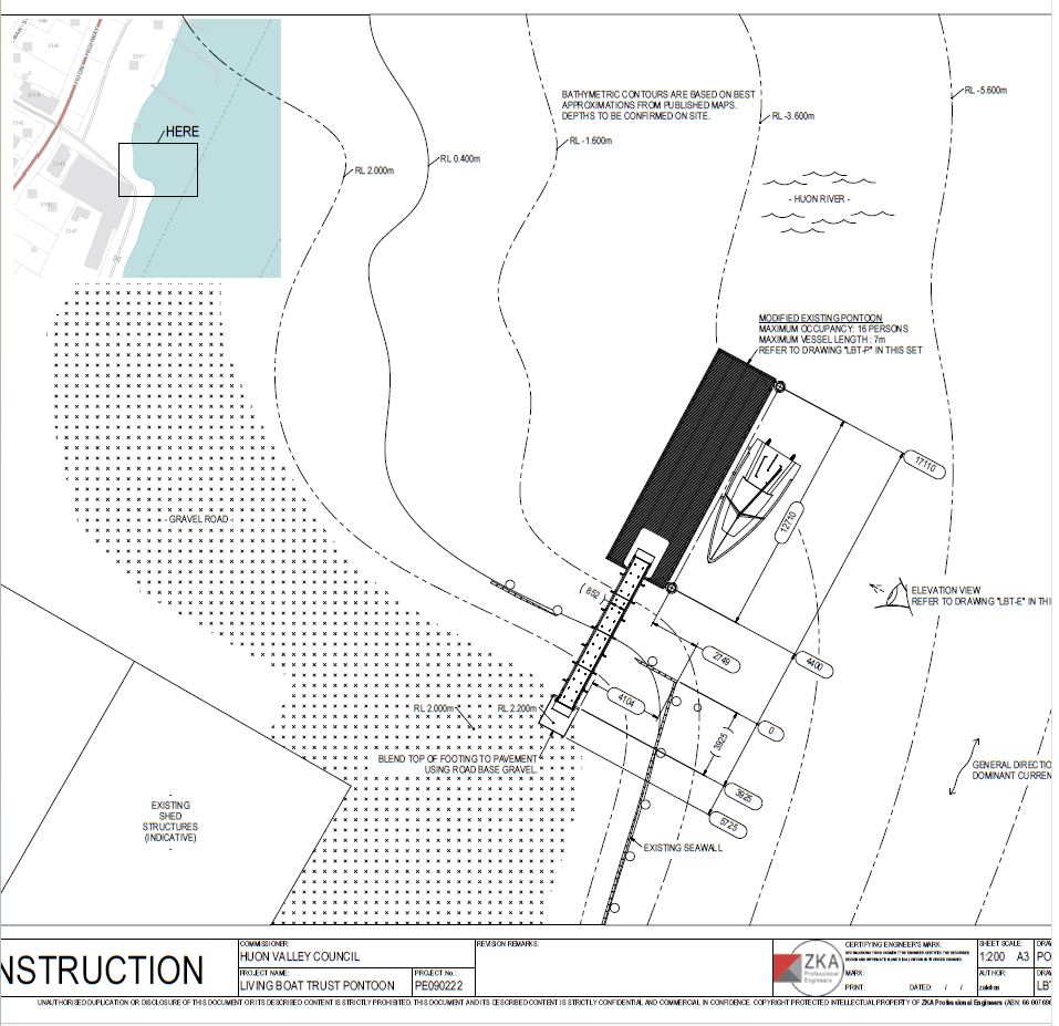
Today, there are no homes on the waterfront side of the Huon Hwy as seen in the above photo; all having been removed for road widening probably in the late 1980s. This land is in part occupied by the Wooden Boat Centre and The Living Boat Trust, both providing jetties for their members. This section of the foreshore is again bustling with activity. The LBT has an application to provide berthing in the vicinity of the original New Road Wharf. The original lease for the Evaporating works is still held by the current owners of the former Franklin Evaporating Works which operated continually for over 100 years, from 1898.
Today, there are no homes on the waterfront side of the Huon Hwy as seen in the above photo; all having been removed for road widening probably in the late 1980s. This land is in part occupied by the Wooden Boat Centre and The Living Boat Trust, both providing jetties for their members. This section of the foreshore is again bustling with activity. The LBT has an application to provide berthing in the vicinity of the original New Road Wharf. The original lease for the Evaporating works is still held by the current owners of the former Franklin Evaporating Works which operated continually for over 100 years, from 1898.
7. The Reclamation piles in place. (PH30-1-5420)
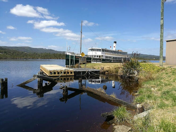
8. The SS/MV CARTELA. (Photo from the internet, author unknown) .
Cartela has been berthed adjacent to the New Road Jetty site awaiting restoration for some time.
Hopefully positive action will begin soon.
For a brief history of Cartela visit https://cartela.org/cartela-a-brief-history/
Hopefully positive action will begin soon.
For a brief history of Cartela visit https://cartela.org/cartela-a-brief-history/
9. Cartela - detail, photo :FHG Librarian, 2023.
10. Living Boat Trust Pontoon plan, supplied by HVC.
Text © Carol Cane, 2023.
Photo credits - as indicated under each item.
Most of the images are from State Library of Tasmania, and National Archives, some - from private collections.
Photo credits - as indicated under each item.
Most of the images are from State Library of Tasmania, and National Archives, some - from private collections.
